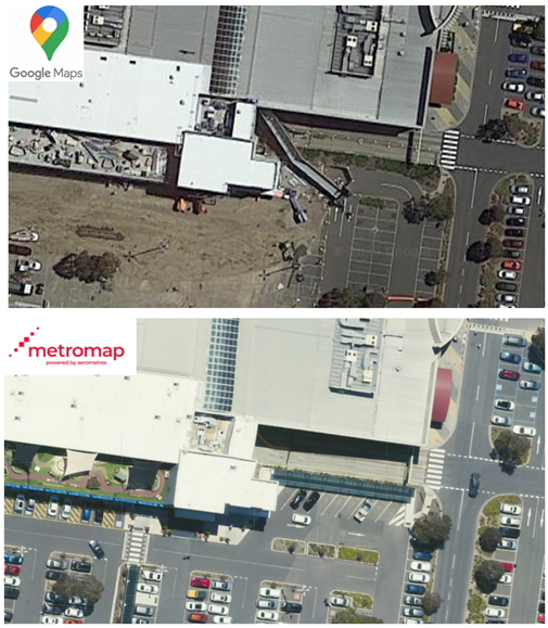
MetroMap Aerial Imagery and free platforms such as Google Maps both offer a view of the ground and its features, objects from above. They can both be used for a range of applications wherein geospatial data is required.
Unlike Google Maps (who take satellite photos once every 2-3 years) MetroMap capture high-resolution aerial imagery, which is exponentially better than satellite imagery. MetroMap also capture images more frequently, up to 3-4 times a year, ensuring customers have access to the latest imagery.
With improvements in technology we can offer this information at more affordable rates.